Margarita Island - General Information
Geography - topography
Margarita Island has a total area of 934 km² and possesses a mountainous terrain and a tropical Caribbean climate.
It is 78 kilometres (48 mi) long and measures roughly 20 kilometres (12 mi) at its widest.
The island is split into two peninsulas joined by an 18 kilometres (11 mi) long isthmus and covers an area of 1,020 square kilometres (390 sq mi). The Isthmus, called the National Park Laguna Restinga, is a popular tourist attraction.
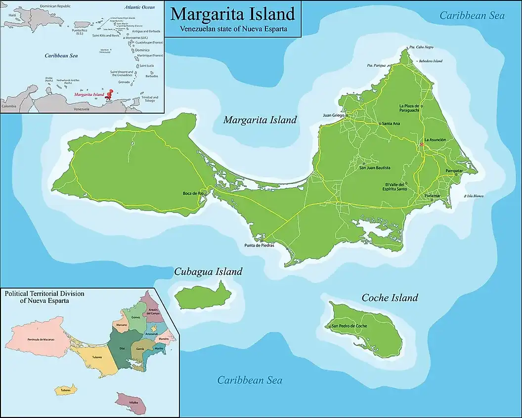

The Macanao peninsula to the west has a central mountain range in the east–west direction. The highest altitude is 760 metres (2,493 ft) at Pico de Macanao. Several smaller ranges derive from this axis following a north–south orientation with deep valleys between them. The most notable of these valleys is San Francisco in the north-central part of the peninsula.
The Paraguachoa peninsula to the East is formed by a mountain range in the north–south direction from Porlamar to Cabo Negro. The highest peaks are San Juan or Cerro Grande at 920 metres (3,018 ft) and El Copey 890 metres (2,920 ft). The peninsulas are connected by the La Restinga isthmus, on which the La Restinga lagoon is located. There are also two breast-shaped hills known as Tetas de Maria Guevara on the isthmus.
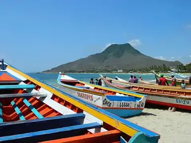
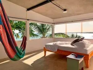
There are at least 70 beaches on the island, which has a 106 miles (171 km) coastline. Popular beaches include Playa El Yaque, Playa Parguito, Playa Caribe, Playa Punta Arenas, Playa El Agua and Playa Puerto Cruz and Margarita is blessed with an average of over 320 days a year of sun and beautiful tropical beaches lined with palm trees.


Geography - Climate
The climate is tropical: sunny, warm and dry.
The island gets about 8 hours of sunshine daily without much variation throughout the year.
Although, ‘officially’ there is mention of a dry season and a rainy season, those terms are very misleading. Rainfall on Margarita is low throughout the year with most months receiving only between 25 and 70mm of rain and only 3 months (Nov-Dec-Jan) receiving more rain (up to 130mm).
The average daytime temperature is 32 °C (90 °F) and the average nighttime temperature is 23 °C (73 °F) with virtually now variation throughout the year – you can count on it that this will roughly be the temperature almost any day of the year.
The average sea temperature is 27 °C (80 °F) – and you guessed it! – virtually no variability during the year.
Being located in the Caribbean Sea near the Earth’s equator, solar rays fall perpendicularly on the island and therefore it is advisable to always use a hat with a wide brim and breathable material, main a tshirt or some covering for bathing and sunscreen when visiting its beaches.
Isla Margarita is located in the extreme southern limit of the trajectory of the hurricanes, which means that it is very rarely affected. However, the hurricane season runs from June to November, and the highest probability is between August and October.
In short, Margarita Island has the perfect vacation climate.


Population
Well, we don’t really know – there are no reliable official counts since 2014, when the population of Margarita was about 490,000. Due to the unstable political economical situation, we can only assume that the population has decreased to below 400,000.
Most of the island’s residents live in the more developed eastern part of the island, which includes the large cities of Porlamar and Pampatar, along with the state capital of La Asunción.
Geography - Towns
Porlamar is the island’s largest city. This is the main commercial centre and has many shops and good restaurants. Around one third of the island’s total inhabitants live in Porlamar. It has two city beaches.
Pampatar is a very popular town, has several beaches, around 50,000 inhabitants and is home to a good number of the larger shopping malls including; Centro Comercial AB (Avenida Bolivar), La Redoma, Rattan Depot, Sambil Margarita. The San Carlos de Borromeo Fortress, constructed in the late 17th century, is located in Pampatar.
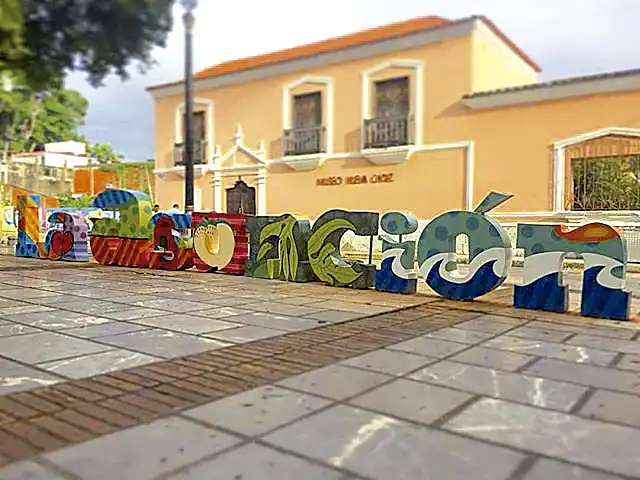
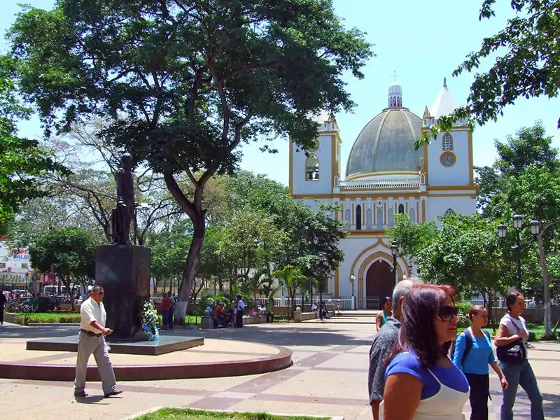
La Asunción is a small yet beautiful, quaint colonial town, which serves as the capital and regional administrative center of Margarita Island as well as the entire Venezuelan State of Nueva Esparta. The city is positioned in a fertile valley and is surrounded by green hills. La Asuncion boasts a fine colonial era pink cathedral.
Juan Griegos is a city on the northern side of Isla Margarita. Its Gothic-style church, constructed in 1850 by Fray Nicholas de Igualdad, is still, along with the lovely bay, the symbol of the city. The La Galera fortress, where in the early 1820s a fierce battle for independence was fought, is located near the city centre. Juan Griego also has some smaller shopping centres and beaches.


Economy
Pre-Covid, Margarita Island was a tourist destination. Beaches used to be full during high season, restaurants and bars, packed. Isla Margarita was the place to be.
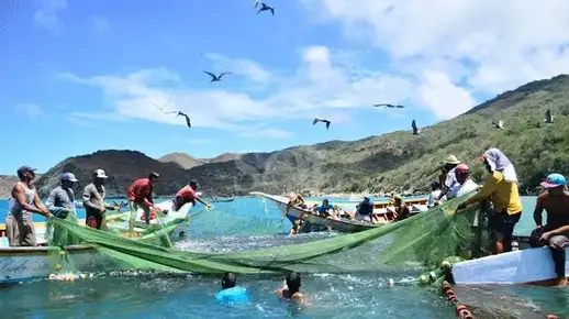
Now, the Island depends mainly on fishing and local services. The food industry, as a basic necessity, is likely the only sector that has shown improvement.
Over the past year, the situation on Margarita Island seems to have improved slightly and much effort is being made to reestablish Margarita as a vacation hub.